Use Cases
How Gridence supports different airspace operations
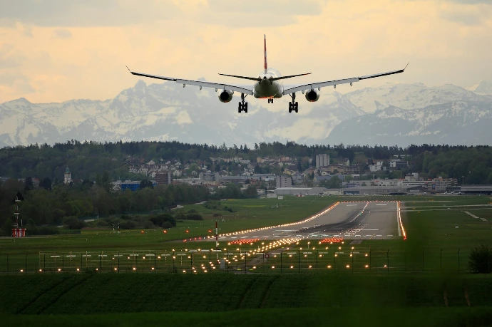
Airports
Airports operate in increasingly complex low-altitude airspace where drones, general aviation traffic, and emerging air mobility services share the same environment. Maintaining situational awareness around the airport perimeter is essential for safe and efficient operations.
The Gridence system provides airports with a real-time picture of local airspace activity. By combining multiple sensors and data sources, it helps operators monitor aircraft and drone traffic, detect unusual activity, and identify potential safety risks early.
Gridence can also enhance pilot awareness by broadcasting local traffic information directly to aircraft through an ADS-B UAT ground station. In addition, monitoring of GNSS interference helps operators understand when satellite navigation may be degraded, supporting safer operational decisions.
ADS-B UAT ground stations are currently operational at Pyhtää and Mikkeli airports in Finland, supporting local airspace awareness and traffic visibility.

Critical infrastructure
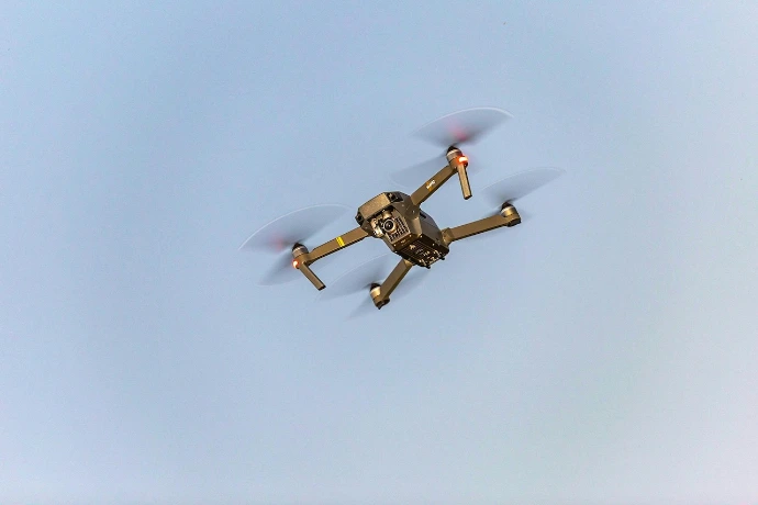
Operators of critical infrastructure such as energy facilities, ports, industrial plants and logistics hubs increasingly need awareness of activity in the surrounding airspace. The growth of drone operations and the rising occurrence of GNSS interference have created new operational and security challenges.
Gridence provides a real-time picture of low-altitude airspace around critical sites. By combining multiple sensors and data sources, the system helps monitor aircraft and drone traffic, detect unusual activity and provide early warning of potential risks.
The system can identify drones operating near sensitive locations and, when possible, estimate the location of the drone operator. This supports faster situational assessment and coordination with security personnel and authorities.
Gridence also monitors GNSS signal conditions, detecting potential jamming or spoofing that may affect navigation and timing systems.
With its modular architecture, the system can be adapted to different environments and security needs, supporting facilities such as ports, energy production sites, industrial areas and transportation hubs.

Cities
Cities increasingly face new challenges in low-altitude airspace as drone operations become more common and urban environments host a growing variety of aerial activities. Authorities therefore need better awareness of what is happening above densely populated areas and critical urban infrastructure.
Gridence provides cities with a real-time picture of local airspace activity. By combining data from multiple sensors, the system helps monitor aircraft and drone traffic and detect unusual or unauthorized activity early. This improves the ability of city authorities and security operators to understand what is happening above public spaces, events, and critical infrastructure.
The system can identify drones operating in restricted or sensitive areas and, when possible, estimate the location of the drone operator. This supports faster situational assessment and coordination with law enforcement and other authorities.
Gridence can also detect GNSS interference, providing awareness of disruptions that may affect navigation systems used by drones and aircraft.
With its modular architecture, the system can be adapted to different urban environments and operational needs, helping cities improve airspace awareness, enhance safety around public events and infrastructure, and prepare for future urban drone services.
Drone test centers
Drone testing centres often conduct multiple flight tests in the same airspace, sometimes involving several operators and experimental aircraft. Maintaining control of the testing environment is essential for safe and efficient operations.
Gridence helps testing centres manage their airspace by dividing the test area into clearly defined operational zones. Operators can monitor in real time whether a drone remains within its assigned sector and receive alerts if it leaves the designated area. This makes it easier to safely conduct multiple tests simultaneously while maintaining separation between different test activities.
The system can also detect GNSS interference in the surrounding area. This helps operators determine whether abnormal flight behaviour is caused by satellite navigation disruption rather than a fault in the drone itself.
Integrated camera systems can also provide visual confirmation and detailed observation of drone behaviour during test flights, supporting more accurate analysis of flight performance and anomalies.
With its modular architecture, Gridence can be adapted to the needs of different testing environments, from small experimental ranges to large multi-operator test areas. The cooperative ground infrastructure can also be deployed as a portable solution, enabling rapid setup in temporary test areas where permanent installations are not feasible.
Interested in Gridence solution?
Gridence helps organizations understand and manage the airspace around their operations.
We are happy to discuss your operational needs and how the system could support your environment. Schedule a free initial consultation